
Heavy snowfall last winter will lead to an influx of water into Lake Powell.
This item is available in full to subscribers.
To continue reading, you will need to either log in to your subscriber account, or purchase a new subscription.
If you are a current print subscriber, you can set up a free website account and connect your subscription to it by clicking here.
If you are a digital subscriber with an active, online-only subscription then you already have an account here. Just reset your password if you've not yet logged in to your account on this new site.
Otherwise, click here to view your options for subscribing.
Please log in to continue |
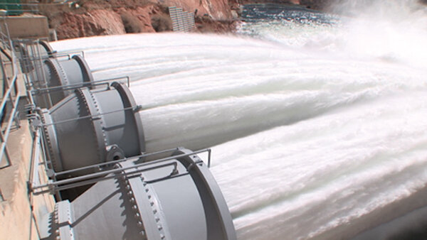
The water year precipitation for the Colorado River Basin from Oct. 1, 2016 to May 31 was 100 to 110 percent of average, reported the Colorado River Forecast Center on Tuesday. Most of that precipitation came in the form of snow, which is now melting and flowing into Lake Powell at a rate of 46,880 cubic feet per second, or 80,000 acre feet a day. The Glen Canyon Dam is currently releasing 25,000 acre feet per day.
Lake Powell reached its lowest elevation of the year on March 15 at an elevation of 3,593 feet. It’s currently at 3,622 feet. The Bureau of Reclamation estimates Lake Powell will peak out at 3,638 feet.


