
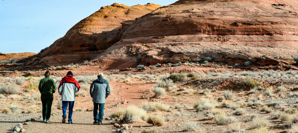
The Regional Trails Alliance started collecting GIS data last month on local hiking and cycling trails, with the aim of planning, funding, building, marketing and maintaining a regional trails map.
This item is available in full to subscribers.
To continue reading, you will need to either log in to your subscriber account, or purchase a new subscription.
If you are a current print subscriber, you can set up a free website account and connect your subscription to it by clicking here.
If you are a digital subscriber with an active, online-only subscription then you already have an account here. Just reset your password if you've not yet logged in to your account on this new site.
Otherwise, click here to view your options for subscribing.
Please log in to continue |
The Regional Trails Alliance started collecting GIS data last month on local hiking and cycling trails, with the aim of planning, funding, building, marketing and maintaining a regional trails map.
The goal is to provide trail information that will serve to entice tourists or visitors to spend an extra day or two exploring the northern Arizona landscape, thus improving the economies of towns, chapters and businesses in the region.
The region encompasses Coconino County’s 5th District, its Navajo Nation counterpart and portions of southern Utah.
Using the collected data, the Regional Trails Alliance (RTA) will create an overall area map, as well as an individual map for each trail. The maps will be reproduced as 8.5 x 11, double-sided, full-color flyers available for hikers to pick up at places like the Page-Lake Powell Hub Tourist Information Center. A regional hiking app and website will also be developed.
Steve Mongrain, the overall coordinator of the RTA project, said the GIS data collected on the local trails will be used to create a hiking app specific to the region, with information about trail length, elevation, ascent and descent, safety requirements, rules and regulations in and around Page, and more.
“We can control the data that we put there,” he said at a Page Parks and Recreation Advisory Board meeting last month. “The app is going to start serving as a basis – and I hope a planning device – for the rest of the county in terms of developing trails.”
This local control of data will set the RTA app apart from more global apps like AllTrails, which are useful for finding hiking locations but often contain misinformation and include unofficial “social” trails.
As of last week, RTA had collected data on the old Discovery Trail at Lake View Nature Park and the Hanging Garden Trail in Glen Canyon National Recreation Area.
The Discovery Trail, a short loop trail located just north of Lake View Elementary School in Page, was established in the early 1990s by Daniel Murray. The project was funded by a grant from the Salt River Project and adopted by fifth-grade students at Lake View, who created the route, built the trail, painted trail markers and created a trail guide.
“Daniel Murray called it the Discovery Trail because there was all this cool stuff that you could see along the trail,” said Paul Ostapuk, who serves as photographer and GIS assistant for the RTA project.
“He had little pink stations that marked places to stop. He had the kids and some of the teachers put a little guidebook together. It had all these stops A to N. You could carry the booklet and read about it. It had artwork, some poems. It was pretty cool. It was fun to have a true nature trail that kids could discover and explore.”
For a variety of reasons, the Discovery Trail eventually fell into disuse and became overgrown. The original route lies within the 106-acre plot that has since been set aside as the Lake View Nature Park.
“Now that the Regional Trails Alliance has been formed, they’re looking for city trails. One concept we came up with was reinvigorating the Discovery Trail. There are some interesting rock formations, and it’s easy enough for kids to do,” Ostapuk said.
At last month’s Parks and Rec meeting, Mongrain described the benefits of the RTA grant project for visitors to Page.
“What is the deliverable to the tourist who walks into the Hub, picks up this 8.5 by 11 flyer about the Discovery Trail and says, ‘Yeah my kids are small, let’s go do this’?” he said.
“They have a QR code on there, and they scan that into their phone. What happens? What do they get? It’s going to be something similar to what we see in AllTrails, but it is going to be specific to the trails of northern Arizona.”
The formation of the RTA was originally proposed by Coconino County 5th District Supervisor Lena Fowler in early 2017 after she learned about the pending closure of the Navajo Generating Station near Page.
A series of meetings from mid-2018 through early 2020 resulted in a list of 22 existing trails, 10 trails in the planning stages and around five fee-based hiking operations. Most of the trails already exist and are known to the public. Generally, all provide parking.
To provide funding for the project, a Visit Arizona Initiative (VAI) Outdoor Recreation Revitalization Grant was awarded to RTA in September 2022 in the amount of $71,232. The Coconino County Board of Supervisors approved the grant in early November 2022.
The grant will be provided on a reimbursement basis over a two-year period from Sept. 16, 2022, to Sept. 16, 2024. In December, Fowler announced that she will provide $5,000 to cover all incidental costs such as transportation and meals, and another $5,000 can be provided as early as July 2023 if necessary. Funds will be held by the Glen Canyon Conservancy.


